I'm jelly I couldn't make this one.
I appreciate the report and really really hope to make the next run.


I'm jelly I couldn't make this one.
I appreciate the report and really really hope to make the next run.


First of many hours of video processing to come.
___________
Tom
-.- . ----- .-- - -.-.
JandDGreens (November 24th, 2018),Java (November 26th, 2018),Jim (November 24th, 2018),open_circuit (November 24th, 2018)

Map and Elevation of Monday and Sunday respectively. Top of the World is very obvious and Long Canyon drop is as well.[/QUOTE]
How do you capture this elevation data? Horizontal axis is time in min? That graph is awesome to show the challenge of the terrain. I've only seen the Garmin action camera (go pro like) with embedded telematics. It will overlay this type of data on your video. Bummer is batter life is only rated at ~45 min with all of its sensors running. Based on my experience with other battery powered tech, real world is likely ~30min.
I think the x-axis must be distance (miles) on that chart. We spent a full day (8-ish hours) on the trail, so it can't be minutes.


I'd agree with miles. About 40 miles per day is what we did on the two trail days.

___________
"A wise and frugal government...shall restrain men from injuring one another, shall leave them otherwise free to regulate their own pursuits of industry and improvement, and shall not take from the mouth of labor the bread it has earned. This is the sum of good government." Thomas Jefferson
JDMYETI (November 26th, 2018)
Miles, duh lol.
That seems reasonable to do once you've got the GPX file. What kind of hardware do you use to capture the data? Is that done with a smart phone? Assuming google maps isn't going to cut it.
___________
"A wise and frugal government...shall restrain men from injuring one another, shall leave them otherwise free to regulate their own pursuits of industry and improvement, and shall not take from the mouth of labor the bread it has earned. This is the sum of good government." Thomas Jefferson
I use my Garmin watches (Forerunner 405 or Fenix 2) or even an old Garmin car GPS (which had a hidden track record mode) to get GPX (or TCX) files.
The Fenix 2 works great for all of my outdoor and multisport uses, and I recommend the Fenix series heartily. I will be testing the Amazfit Bip (~$60 GPS smartwatch) on some future outings as well.
JDMYETI (November 26th, 2018)
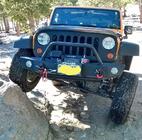
This video gives some depth to angle as well as the rocks. The group went up and then back down, just click past the first parts to get to the hill. https://youtu.be/xzJIbfzbLNU
There is a lot of room to play around, you are correct.
Tom (November 26th, 2018)
___________
Tom
-.- . ----- .-- - -.-.

Looked like a great time guys! Thanks for taking the time to share the pics, vids and great info.
Tower Arch Video
Some of the transitions are a bit wierd/jumpy. My apologies. I was trying something in camera the should have worked, but didn't in MS Movie Maker.
___________
Tom
-.- . ----- .-- - -.-.
JandDGreens (December 10th, 2018),Jim (December 9th, 2018),open_circuit (December 9th, 2018)
Last two videos
___________
Tom
-.- . ----- .-- - -.-.
Getaklu (December 9th, 2018),open_circuit (December 9th, 2018)


You're breaking my heart guys but it's nice to live it vicariously from the flattest state in the country!
___________
Chris in Florida
 Posting Permissions

 Reply W/Quote